Recreation Along the Laguna
Trails • Water Activies • Leave No Trace
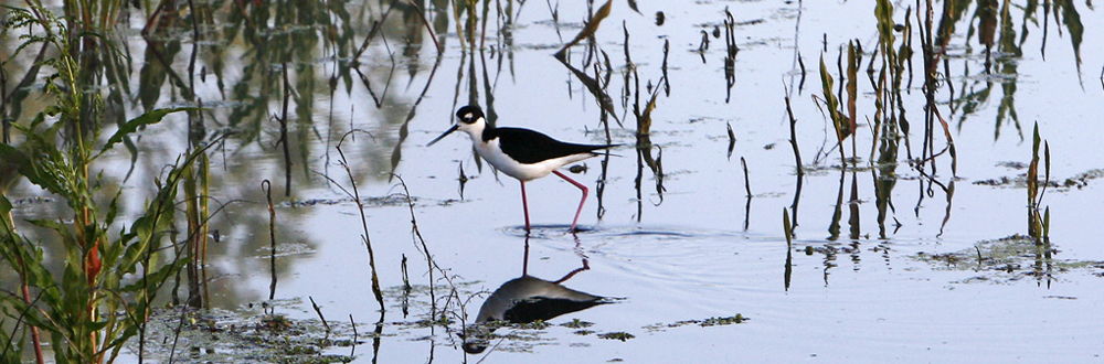
The Laguna de Santa Rosa is the largest freshwater wetlands complex on the northern California coast, offering great opportunities to enjoy fresh air and peaceful moments throughout the year. Spanning over 30,000 acres, the Laguna is a remarkable ecological system. It features a diverse landscape of creeks, open water, perennial marshes, seasonal wetlands, riparian forests, oak woodlands, and grasslands, which collectively provide habitats for a wide range of birds and wildlife.
Here are just a few of the activities you can enjoy in the Laguna de Santa Rosa Watershed. We invite you to explore the charming towns and cities scattered throughout the watershed, as well as the peaceful trails and waterways alongside the Laguna. Happy exploring!
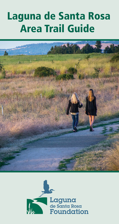
Trails
Download our Trails GuideHeadwaters Trail, Cotati
This fairly flat, urban walk includes several small parks and the headwaters of the Laguna. The full loop is 3 miles. View MapSouthern Laguna Discovery Trail, Rhonert Park
This 2.6-mile out-and-back trail was created as part of the Southern Laguna Restoration project, a collaboration between the Sonoma County Water Agency and the Laguna de Santa Rosa Foundation. This easy, flat trail is great for birding, hiking, and running. View MapLaguna de Santa Rosa Trail, Santa Rosa
This trail runs 2.4 mi. north-south between Hwy 12 and Occidental Rd. along the east side of the Laguna channel. The trail includes a loop and overlook around Kelly Wetlands and connects to the 0.6-mi. dirt, pedestrianonly loop (no-dogs). The Laguna trail also connects to pedestrian-only dirt trails throughout Meadowlark field. View MapLaguna Wetlands Preserve, Sebastopol
This complex of properties and trails spans the eastern border of Sebastopol along the Laguna both north and south of Hwy 12. Behind the Sebastopol Community Center is a short walking trail that loops around two created wetlands. View MapLaguna Uplands Preserve, Sebastopol
This small open space preserve is located at the end of Palm Ave. The property is characterized by moderately sloping hillsides, with scenic views across the Laguna looking east toward Taylor Mountain and Santa Rosa. Approximately 0.5 mi. of dirt trails traverse the property. View MapSanta Rosa Creek Trail System, Santa Rosa
There are many miles of creeks that flow through Santa Rosa which can be enjoyed year round. Whether roaring along in a whipping winter wind or trickling over rocks in the sultry summer shade, our ever-changing creeks provide a refreshing touch of nature in the urban environment. View MapWater Activites
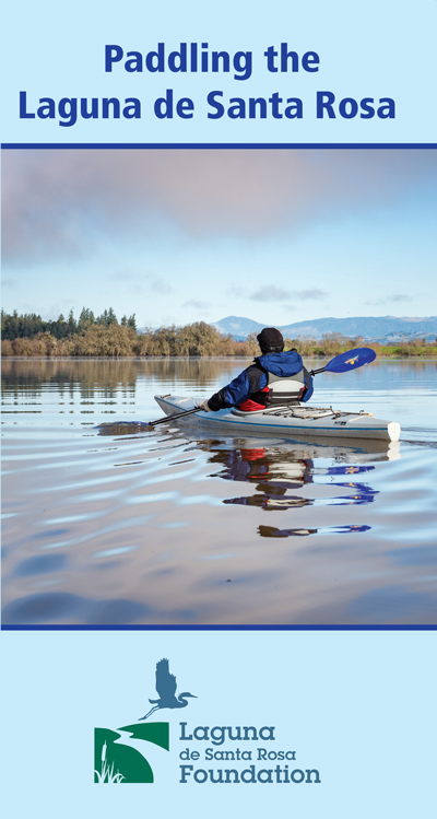
Download our Paddling GuideThe largest tributary of the Russian River, the Laguna drains a 254-square-mile watershed. It serves as a natural holding basin during our wet season and as an overflow area for the Russian River during floods, slowing and capturing floodwaters and easing their impact on lower Russian River communities. As the receiving water of a watershed where most of the county’s human population lives, it is a landscape feature of critical importance to Sonoma County’s water quality, flood control, and biodiversity.
Paddling the Laguna de Santa Rosa
Kayaking and canoeing in the Laguna is most desirable (and sometimes only possible) during the winter months. The Laguna is a shallow floodplain environment and there needs to be enough water under the boat to allow navigation and to avoid dense, tangled mats of the invasive aquatic plant, Ludwigia. The best conditions are usually within one to two weeks after heavy rainfall.Waterfowl Hunting, Laguna Wildlife Area
Waterfowl hunting is allowed in the Occidental Road Unit of the Laguna Wildlife Area each winter from mid-October to the end of January. Care is warranted. Use common sense; if you hear shots from an area, stay clear of that area. Please check the California Department of Fish and Wildlife website for exact hunting season dates, rules, and regulations.Fishing
The Laguna is a seven-mile-long waterway with numerous fishing spots. In summer, low water levels make fishing more challenging. However, winter brings higher water levels that support diverse fish species including bass, crappie, perch, and bluegill. Fishing regulations in California vary seasonally, covering when and where you can fish, limits on fish size and quantity, and other rules. Additionally, it's important to review local regulations concerning access to waterways.Leave No Trace
In early 2021, Sonoma County Tourism and Sonoma County Regional Parks entered a partnership with the national Leave No Trace organization to develop a county-wide responsible recreation initiative to help mitigate environmental impacts in area parks, preserves, and other outdoor recreation locations. Part of SCT and Regional Park’s partnership with Leave No Trace involved the development of a Sonoma County-tailored version of the Seven Principles.
Leave No Trace is a personal outdoor ethic that anyone can practice when spending time outdoors. Any time you can put Leave No Trace into action, you are helping to protect all of our favorite outdoors areas—from your backyard to the backcountry.
Learn more about The Sonoma County Leave No Trace Seven Principles.
[ top ]
. Banner Image by Lucy Aaron